

On tap for Oct 11: Sunshine and warmer-than-normal afternoons this week
Enjoy the sunshine, and plan for a warm stretch of weather before a refreshing taste of fall arrives by the weekend.
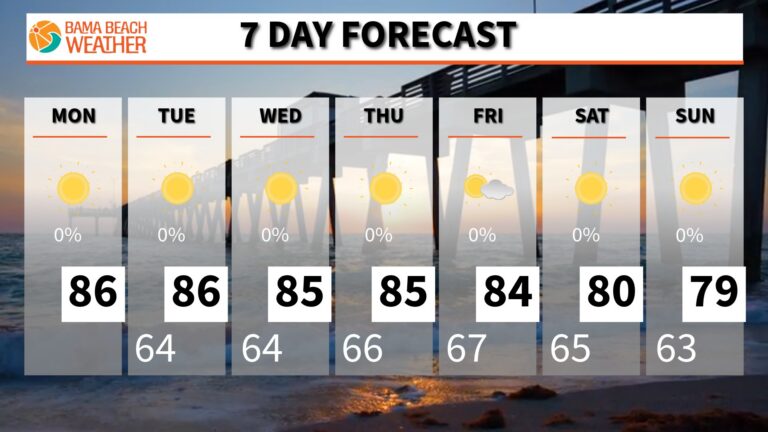
Enjoy the sunshine, and plan for a warm stretch of weather before a refreshing taste of fall arrives by the weekend.
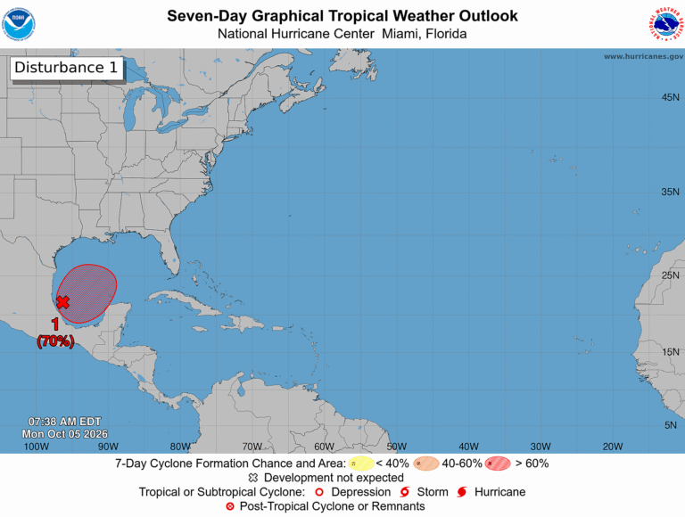
A tropical disturbance in the Gulf is becoming a little more organized, and the National Hurricane Center says tropical development is becoming more likely as we progress through this week. As of Monday morning, October 5, a trough of low pressure is producing disorganized showers and thunderstorms over the southwestern Gulf. Conditions are only marginally…
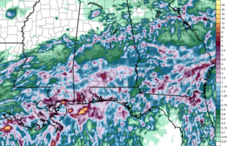
It’s been a soggy Saturday for parts of the area, and the threat of more heavy rain in Coastal Alabama continues through Sunday. Multiple rounds of rain are expected through at least Sunday afternoon, with another 4 to 6 inches of rain possible. Heavy Rain Could Lead to Flooding A Flood Watch remains in effect…
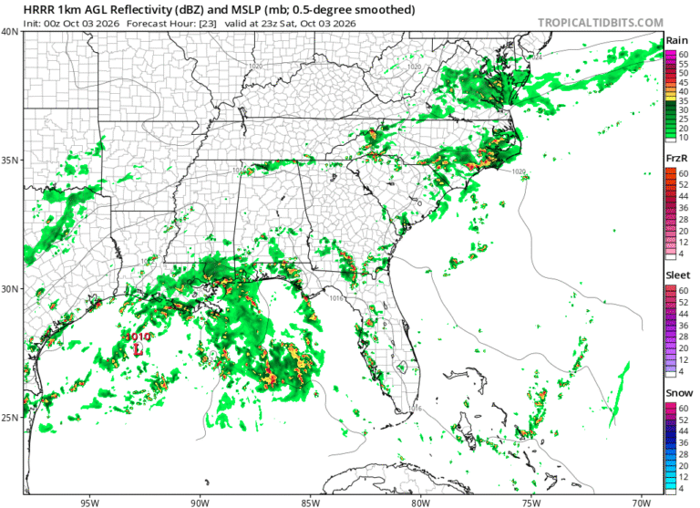
The heaviest rainfall will not be evenly distributed, so some areas could receive considerably less while others pick up several inches.
We have officially passed the statistical peak of the 2026 Atlantic hurricane season

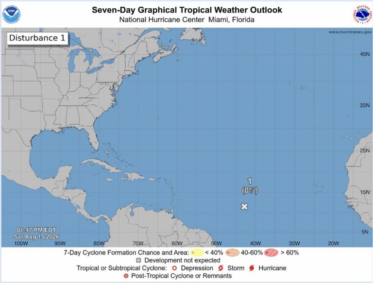
Development chances drop this morning, but still watching a disturbance in the tropics
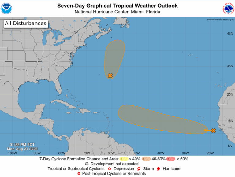
The Atlantic basin is becoming a little more active, with two areas of interest being monitored for possible tropical development. Neither system poses an immediate threat to the Gulf Coast, but both are worth watching to see if we will have our fourth named storm of the 2026 Atlantic Hurricane Season. AL95: Short-Lived Development Possible…
Boating conditions along the Alabama coast will remain somewhat choppy through much of the week, with 2-foot seas and west to southwest winds generally around 10–15 knots. Monday afternoon could bring gusts up to 20 knots. A few showers and thunderstorms will be possible each day, especially from Tuesday through Friday. Winds and seas will…
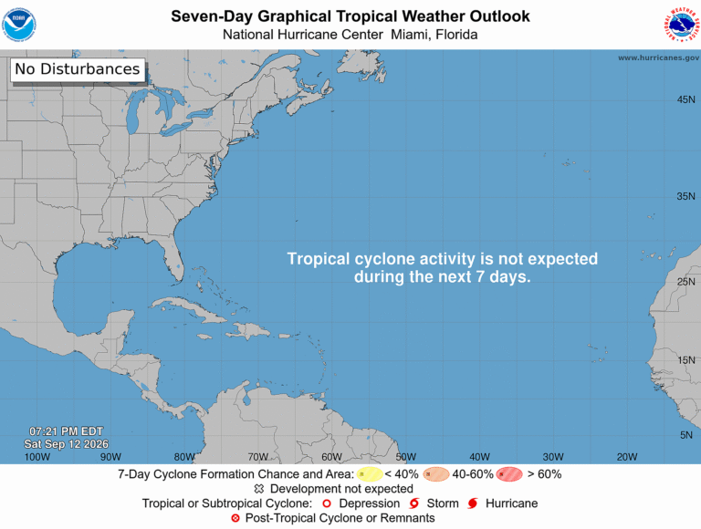
Tropical activity ceases once again in the Atlantic, and should remain quiet over the next several days.
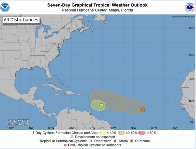
Still watching two tropical waves with low to medium chances of development, but that chance looks to be fading.
We use cookies to analyze website traffic and optimize your experience. By accepting cookies, your data will be combined with all other users' data.
Manage your cookie preferences below:
Essential cookies enable basic functions and are necessary for the proper function of the website.
These cookies are needed for adding comments on this website.
Statistics cookies collect information anonymously. This information helps us understand how visitors use our website.
Google Analytics is a powerful tool that tracks and analyzes website traffic for informed marketing decisions.
Service URL: policies.google.com (opens in a new window)
Marketing cookies are used to follow visitors to websites. The intention is to show ads that are relevant and engaging to the individual user.
A video-sharing platform for users to upload, view, and share videos across various genres and topics.
Service URL: www.youtube.com (opens in a new window)
You can find more information in our Cookie Policy and Privacy Policy.